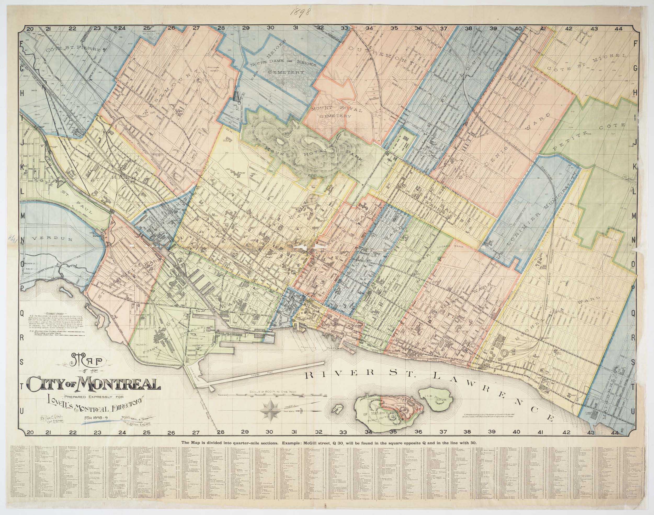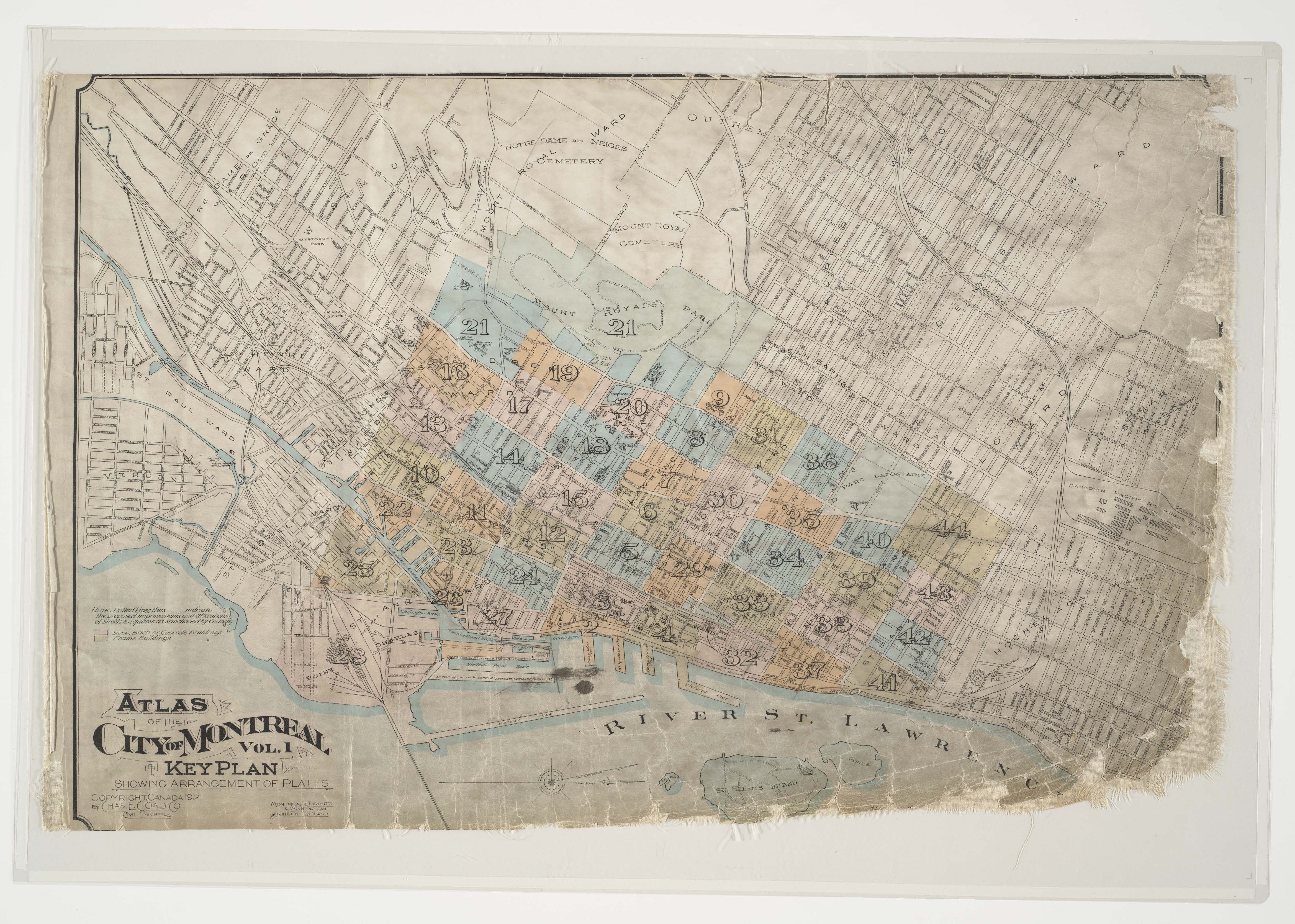
City of Montreal key plans showing arrangement of plates. Canada 1912. By Chas. E. Goad Co. Civil Engineers. From Volume 1 of Atlas of the city of Montreal and vicinity : in four volumes, from official plans, special surveys, showing cadastral numbers, buildings & lots
You can download a full resolution version from our catalogue or you can drop by anytime during Rare Books and Special Collections opening hours to consult the original.
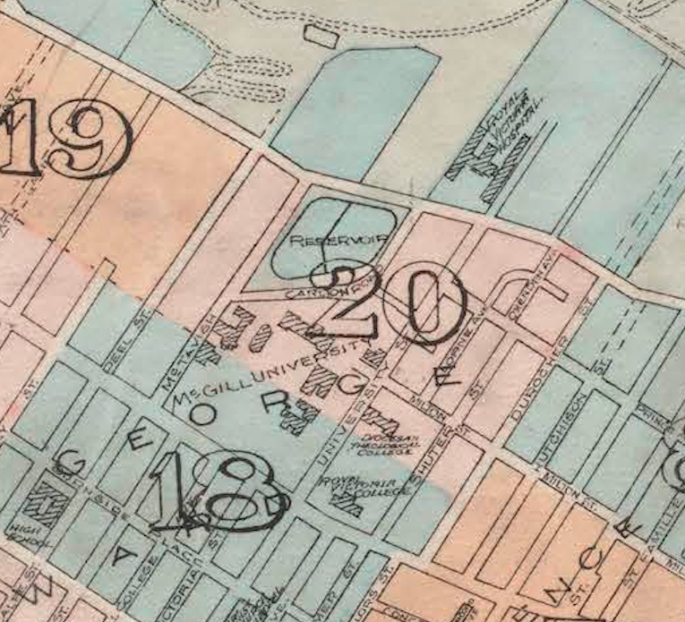
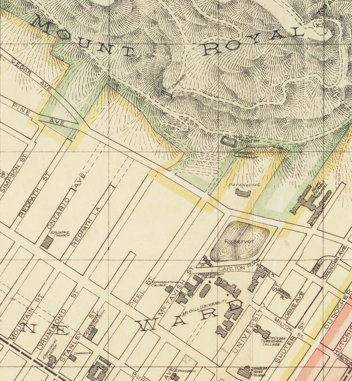
Close of up Plate 18 & 20. City of Montreal key plans showing arrangement of plates. Canada 1912. By Chas. E. Goad Co. Civil Engineers.